


 Vietnamese
 中文
中文
 日本語
日本語
 한국어
한국어
 Français
 Русский
 Deutsch
 Español
 Bahasa Indonesia
 ไทย
ไทย
 ພາສາລາວ
 ខ្មែរ
ខ្មែរ


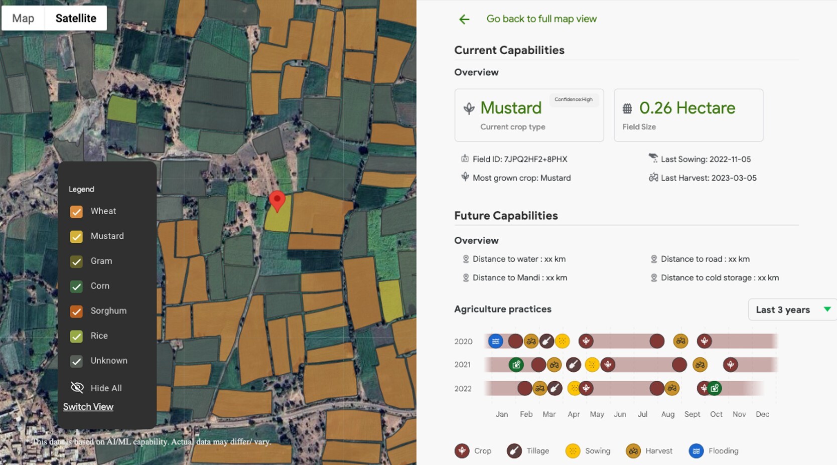 Illustration of the AMED API data interface – a satellite map automatically identifies different crop types (wheat, rapeseed, corn, etc.) using AI, along with detailed information on each field such as area and planting history. (Photo: Google) Illustration of the AMED API data interface – a satellite map automatically identifies different crop types (wheat, rapeseed, corn, etc.) using AI, along with detailed information on each field such as area and planting history. (Photo: Google) |
The Agricultural Landscape Understanding (ALU) API, launched in India last year, and the Agricultural Monitoring and Event Detection (AMED) API, released earlier this year, are now being made available to trusted testers in Vietnam, Malaysia, Indonesia, and Japan.
The models use remote sensing and machine learning to help governments, agribusinesses, and innovators build targeted, cost-effective solutions for the farming sector.
Alok Talekar, Lead, Agriculture and Sustainability Research, Google DeepMind, said that Google is focusing on rice, a crop central to Vietnam’s food system, and the AI models are able to monitor individual fields.
“For every field, we are able to tell you what the most likely crop is and what their corresponding confidence is along with sowing and harvesting dates. This data is available again for many years going backwards, somewhere around five years probably,” said Alok, adding, “And the timely access to this information is going to enable data-driven, evidence-based sort of allocation of resources. We want to ensure whoever is investing the most money in agriculture is able to be more efficient with their delivery of services and benefits to farmers.”
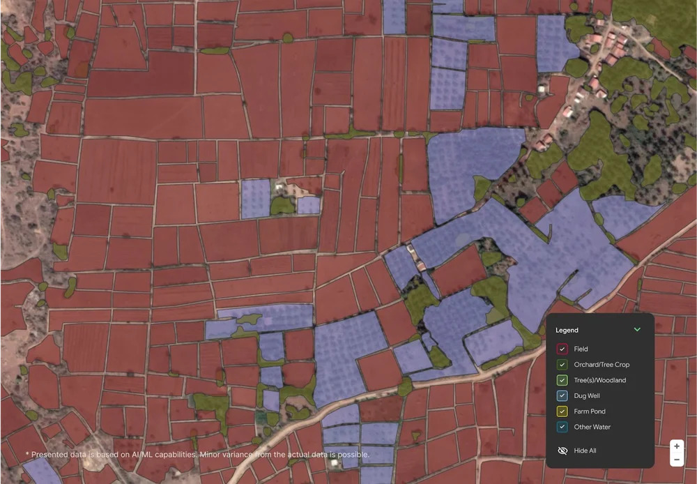 Illustrative map of data from Google’s ALU API – AI analyzes satellite imagery to identify boundaries of fields, orchards, ponds, and forested areas, helping to systematize agricultural landscape information. (Photo: Google) Illustrative map of data from Google’s ALU API – AI analyzes satellite imagery to identify boundaries of fields, orchards, ponds, and forested areas, helping to systematize agricultural landscape information. (Photo: Google) |
The ALU API maps fields, water bodies, and vegetation boundaries, while the AMED API, which builds on ALU API, delivers critical field-level insights on the most cultivated crops, and their sowing and harvest timelines at individual field levels. AMED API also refreshes data actively, approximately every 15 days, helping detect agricultural events in individual fields throughout a country’s agricultural landscape.
As Vietnam advances digital agriculture under its National Digital Transformation Program and adapts to climate challenges in the Mekong Delta and Central Highlands, these AI models are expected to serve as critical data infrastructure for precision farming and smarter policy planning.